North West Ontario Orthophotography Project (NWOOP) 2017 Digital Elevation Model (DEM)Coordinate system: 3857 - "WGS84 Web Mercator (Auxiliary Sphere)" Abstract:The North West Ontario Orthophotography Project (NWOOP) 2017 Digital Elevation Model (DEM) is a 2m raster elevation product that provides a generalized representation of both surface and ground features based on image correlation using aerial photography. The product was generated by an imagery contractor for the purpose of ortho-rectifying orthophotography collected across areas of North West Ontario in the spring of 2017. The DEM data is available in the form of packaged 1km x 1km non-overlapping tiles. |
Additional Documentation
-
Metadata Information
Language: eng; CANLast Update: 2018-05-16Other Maintenance Requirements:fb00097a-5945-4aff-a6eb-2b9a1ef89136Metadata Contact:Scholars Portal, Ontario Council of University Libraries Toronto Ontario, CanadaContact Instructions:datagis@scholarsportal.infoMetadata Standard:North American Profile of ISO19115:2003 - Geographic Information -
Citation Information
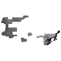
Ontario Ministry of Natural Resources Peterborough Ontario, CanadaThemes or Categories of the Resource: elevationKeywords:Remote Sensing, Imagery, Orthophotography, Elevation, Raster, Digital Elevation Model, DEM, MODELSDIGITAL ELEVATION MODEL, ELEVATION, MODELSRemote sensing, Télédétection, Aerial photography, Photographie aérienne, Models, ModèlePlace Keywords:Continent > North America > Canada > OntarioPurpose:The DEM raster product has been generated by the contractor from a classified LAS format vector point cloud elevation dataset. The NWOOP 2017 DEM was delivered to MNRF as a derivative product of the NWOOP imagery acquisition project, as it was produced for use in the process of image orthorectification. It is important to note that the DEM does not represent a full ‘bare-earth’ elevation surface. Unassigned classes, where the points not classified as Ground have been removed and interpolation has occurred across the resulting voids. Points classified as Ground have not been assessed for accuracy to determine if they represent true ground features. Some features are still raised above ground surface, such as larger buildings, larger forest stands and other raised features. The product is being distributed in the original state delivered by the imagery contractor without modification.Dataset Language:Status: completedUpdate Frequency: asNeededSpatial Representation Type: gridExtentWest Longitude: -94.76225East Longitude: -88.20096North Latitude: 50.14477South Latitude: 47.96017
Supplemental Information: -
Spatial Representation - Grid:
Number of dimensions: 2Axis dimensions properties: -
Reference System Information
-
Data Quality Information
Scope Level: dataset -
Distribution Information
Distributor:Ontario Ministry of Natural Resources Peterborough Ontario, Canada