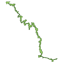
Niagara Escarpment Plan BoundaryCoordinate system: 4269 - "NAD83" Abstract:The Niagara Escarpment Plan Boundary represents the area of jurisdiction in which the policies and objectives of the Niagara Escarpment Plan apply. The outer boundary of the area covered by the Niagara Escarpment Plan is fixed and inflexible, and can be changed only by a Plan Amendment. It is formed by a combination of such features as roads, railways, electrical transmission lines, municipal and property boundaries, lot lines, rivers and topographic features. The Niagara Escarpment Planning and Development Act, serves as the framework of objectives and policies to strike a balance between development, preservation and the enjoyment of the Escarpment and to provide for the maintenance of the Niagara Escarpment and land in its vicinity substantially as a continuous natural environment, and to ensure only such development occurs as is compatible with that natural environment. Additional information can be found at: http://www.escarpment.org |
Additional Documentation
-
Metadata Information
Language: eng; CANLast Update: 2014-05-28Other Maintenance Requirements:190647bc-4597-4552-a678-643f05a55539Metadata Contact:Scholars Portal, Ontario Council of University Libraries Toronto Ontario, CanadaContact Instructions:gis@scholarsportal.infoMetadata Standard:North American Profile of ISO19115:2003 - Geographic Information -
Citation Information
Niagara Escarpment Commission Georgetown Ontario, CanadaThemes or Categories of the Resource: environmentKeywords:NIAGARA ESCARPMENT PLAN AREA, NIAGARA ESCAPMENT PLAN, NEP, ESCARPMENT PLAN, GREENBELT PLAN, ESCARPMENT, LAND MANAGEMENT, LAND USE PLANNING, LAND USE, PLANNING, DEVELOPMENT, SUSTAINABLE DEVELOPMENT, MUNICIPAL PLANNINGLAND USE, LAND USE PLANNING, PLANNING, DEVELOPMENT, SUSTAINABILITYLand management, Gestion des terres, Planning, Planification, Development, Développement, Sustainable development, Développement durablePlace Keywords:Continent > North America > Canada > OntarioPurpose:To depict the boundary of the Niagara Escarpment Plan Area for the purposed of administering the Niagara Escarpment Plan.Dataset Language:Status: onGoingUpdate Frequency: asNeededSpatial Representation Type: vectorProcessing Environment:ArcGIS 9.x file geodatabaseExtentWest Longitude: -81.776235East Longitude: -79.045421North Latitude: 45.327784South Latitude: 43.046740
Supplemental Information: -
Spatial Representation - Vector
Geometric Objects:Object Type: compositeObject Count: 14 -
Reference System Information
-
Data Quality Information
Scope Level: dataset
Process step:Digitized from Ontario Base Maps (OBM): 1:10,000. -
Distribution Information
Distributor:Ontario Geospatial Data Exchange, Ministry of Natural Resources (OMNR) Peterborough Ontario, Canada -
Related Links