Forest Resources Inventory (FIM v2 3D) Packaged ProductCoordinate system: 26915 - "NAD83 / UTM zone 15N" Abstract:This version of the Forest Resource Inventory (FRI) complies with the standards outlined in the Forest Information Manual 2007 Technical Specifications (FIM v.2). The inventory's extent is for the entire unit, and is the standard accepted FRI deliverable provided to clients since 2004. The 3D version of the inventory allows GIS users to view the forest data in 3 Dimensions (z-scale is stored) using specialized GIS Software and Hardware. Using specialized hardware and software, the imagery is displayed to the FRI Interpretation Specialist in a 3D environment by serving up reference point data that was captured by the aircraft during the imagery-capture flight (height of land, altitude, aircraft pitch, yaw etc.). The completed unit is processed by the FRI GIS Officers and Project Technicians using internally-written quality assurance routines to ensure that the final version of the inventory is error-free and conforms to FIM 2007 (v.2) specifications. Documentation about the data structure is provided with the packaged product. |
-
Metadata Information
Language: eng; CANLast Update: 2014-06-06Other Maintenance Requirements:7ef7f1e9-6db6-4f56-86d4-cd7f2cb9c82aMetadata Contact:Scholars Portal, Ontario Council of University Libraries Toronto Ontario, CanadaContact Instructions:gis@scholarsportal.infoMetadata Standard:North American Profile of ISO19115:2003 - Geographic Information -
Citation Information
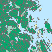
Ontario Ministry of Natural Resources Peterborough Ontario, CanadaThemes or Categories of the Resource: environmentKeywords:FORESTS, FOREST MANAGEMENT, FORESTRY, FOREST MANAGEMENT PLAN, FOREST INVENTORY, FOREST RESOURCESFORESTS, FOREST MANAGEMENT, FORESTRY, FOREST INVENTORIES, FOREST RESOURCESForests, Forêt, Forest management, Gestion forestière, Forestry, ForesteriePlace Keywords:Continent > North America > Canada > OntarioPurpose:Forest Management Planning.Dataset Language:Status: onGoingUpdate Frequency: asNeededSpatial Representation Type: vectorExtentWest Longitude: -95.15699East Longitude: -74.30798North Latitude: 56.85012South Latitude: 41.67230
Supplemental Information: -
Reference System Information
-
Data Quality Information
Scope Level: dataset -
Distribution Information
Distributor:Ontario Geospatial Data Exchange, Ontario Ministry of Natural Resources (OMNR) Peterborough Ontario, Canada