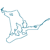
Fish Pathogen Management Zone Boundary SourceCoordinate system: 4269 - "NAD83" Abstract:The Fish Pathogen Boundary Segment layer forms the boundary of the Fish Pathogen Management Zones. It is made up of segments that were taken from the Ontario Road Network. This data class was created in order to store the road name information associated with each segment that makes up the fish pathogen management zone boundary. |
Additional Documentation
-
Metadata Information
Language: eng; CANLast Update: 2013-06-06Other Maintenance Requirements:55917450-629e-4eed-8581-c0c30ef66728Metadata Contact:Scholars Portal, Ontario Council of University Libraries Toronto Ontario, CanadaContact Instructions:gis@scholarsportal.infoMetadata Standard:North American Profile of ISO19115:2003 - Geographic Information -
Citation Information
Ontario Ministry of Natural Resources Peterborough Ontario, CanadaThemes or Categories of the Resource: environmentKeywords:FISH, FISHERIES MANAGEMENT, WATER MANAGEMENT, FISH DISEASES, KOI HERPESVIRUS, FISHERY RESOURCES, SPRING VIRAEMIA OF CARP, VIRAL HEMORRHAGIC SEPTICEMIA, FISH PATHOGEN MONITORING, VHSCOMMUNITIESFish, Poisson, Fisheries management, Gestion des pêches, Boundaries, FrontièrePlace Keywords:Continent > North America > Canada > OntarioPurpose:This dataclass was created in order to store the road name information associated with each segment found in the fish pathogen boundary segments layer. This will enable road names to be labeled on maps of the Fish Pathogen Management Zones.Dataset Language:Status: onGoingUpdate Frequency: asNeededSpatial Representation Type: vectorExtentWest Longitude: -84.328598East Longitude: -74.320109North Latitude: 46.795836South Latitude: 41.676556
Supplemental Information: -
Spatial Representation - Vector
Geometric Objects:Object Type: curveObject Count: 823 -
Reference System Information
-
Distribution Information
Distributor:Ontario Geospatial Data Exchange, Ministry of Natural Resource (OMNR) Peterborough Ontario, Canada