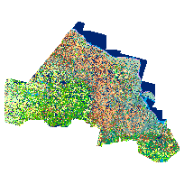
Far North Land CoverCoordinate system: 4269 - "NAD83" Abstract:Revision Note: Please note that this dataset has been revised and is available from the Land Information Ontario (LIO) Warehouse. Far North Land Cover is an enhanced land cover dataset that includes remote sensing imagery, as well as other data such as geology and elevation, to create a comprehensive land cover database for the north. Unique ecologically defined features are provided and are an enhancement over previous versions of land cover that relied on spectral data alone. Ecological classifications include water, marsh, swamp, peatland, fen, bog, treed, mining, bedrock, and more. This land cover has a vintage across the entire Far North of 2005-2011. The entire data product are provided in both grid (raster) and vector format and are broken into layers that cover UTM zones 15, 16 and 17. The classification hierarchy for this product is: Class, Group, and Section. All grid (raster) data and associated vector data have been provided in one .zip package and are available for direct download. |
Additional Documentation
-
Metadata Information
Language: eng; CANLast Update: 2013-05-08Other Maintenance Requirements:ab1da0f2-7bba-430b-af11-d503865ff130Metadata Contact:Scholars Portal, Ontario Council of University Libraries Toronto Ontario, CanadaContact Instructions:gis@scholarsportal.infoMetadata Standard:North American Profile of ISO19115:2003 - Geographic Information -
Citation Information
Ontario Ministry of Natural Resources Peterborough Ontario, CanadaThemes or Categories of the Resource: geoscientificInformationKeywords:Ecological Land Classification, Land use, Land cover, Land cover classificationSCIENCE, RESEARCH, PLANNING, DEVELOPMENT, LAND USE PLANNING, BIODIVERSITY, LAND CLASSIFICATION, REGIONAL PLANNING, ECOLOGYLand management, Gestion des terres, Development, Développement, Classification, Classification, Ecology, Écologie, Aboriginal lands, Terres autochtones, Aboriginal affairs, Affaires autochtonesPlace Keywords:Continent > North America > Canada > OntarioPurpose:The aim of creating a revised land cover for the Far North is to produce a consistent map to meet regional - to landscape level analysis (1:100,000).Dataset Language:Status: onGoingUpdate Frequency: asNeededSpatial Representation Type: vectorProcessing Environment:ESRI Geodatabase including raster and vector feature datasets.ExtentWest Longitude: -96.003157East Longitude: -78.189511North Latitude: 57.270858South Latitude: 48.704798
Supplemental Information: -
Spatial Representation - Vector
Geometric Objects:Object Type: compositeObject Count: 7603905 -
Reference System Information
-
Data Quality Information
Scope Level: dataset
Quaternary Geology of Ontario (SV04-02.021) (GOO): Used in GIS processes to aid creation of topographic layers used as input into the classification process. Also used as a reference to understand broad scale soil and topographic conditions contributing to overall land cover trends.Landsat Mult-ispectral Imagery (Landsat, TM): Multi-spectral 30 meter resolution Landsat 5 thematic mapper imagery was used as the primary data source for land cover classification. Most boundaries and class attribution began with this data and may or may not have been modified by others. Image processing details are available: at http://landsat.usgs.gov/Landsat_Processing_Details.phpNational Hydro Network, Canada (NHN): Polygonal representations of lakes and large rivers were used to spatially define and contextually classify water bodies. The linear stream layer network was also included as context to classify land cover classes and topographic features often associated with flowing water (for example thicket swamps). Additional metadata available through GeoBase: http://www.geobase.ca/geobase/en/metadata.do?id=87066E9A-94EE-680A-B1BA-591F4688DB7D1 arc second Shuttle Radar Topography Mission (SRTM, DEM): This is a Digital Elevation Model (DEM) used to generate topographic upland and riparian area and wetland masks as input into the land cover classification process to ensure land cover classes are defined by spatial vegetation (imagery) and topographic (DEM) information.Provincial Satellite Derived Disturbance Mapping: Provincial Satellite Derived Disturbance Mapping was used as a mask in the land cover mapping process. All spatial disturbance events were incorporated into land cover and further classified as either open or woody disturbance features using current imagery. -
Distribution Information
Distributor:Ontario Geospatial Data Exchange (OGDE), Ministry of Natural Resources (OMNR) Peterborough Ontario, Canada