Fisheries Data Catalog, Guelph AreaCoordinate system: 4269 - "NAD83" Abstract:The Guelph Area Fisheries Data Catalog contains geo-referenced records of fisheries and fish habitat surveys and events within the Guelph Administrative Area of Guelph District, OMNR. Records from a wide variety of agencies, organizations and individuals are included in the catalog. Each record is geo-referenced as a point, and is flagged as belonging to one or more of the following 20 information categories:
Each record also includes a file number which references a specific hardcopy file within the Guelph Administrative Area's fisheries filing system. The catalog itself is available as a packaged product in the LIO Warehouse. |
-
Metadata Information
Language: eng; CANLast Update: 2013-04-16Other Maintenance Requirements:79cdf768-ec87-44e6-93a3-b7f7248a2eabMetadata Contact:Scholars Portal, Ontario Council of University Libraries Toronto Ontario, CanadaContact Instructions:gis@scholarsportal.infoMetadata Standard:North American Profile of ISO19115:2003 - Geographic Information -
Citation Information
Ontario Ministry of Natural Resources Peterborough Ontario, CanadaThemes or Categories of the Resource: environmentKeywords:Fish, FISH COMMUNITIES, GUELPH MNR DISTRICT, FISHERIESFISHERIES MANAGEMENT, FISHERIES, FISHERY RESOURCES, FISH HABITAT, FISH COMMUNITIESFish, Poisson, Fisheries, Pêcheries, Fish farming, PisciculturePlace Keywords:Continent > North America > Canada > OntarioPurpose:This dataset serves mainly as a catalog or reference tool for the Guelph Administrative Area's fisheries filing system. Users can review a geographic area using this dataset, identify records they have interest in, then retrieve the corresponding hardcopy files from the filing system using the 'File Name' attribute. The catalog is used 1) to determine the presence and nature of fisheries and/or fish habitat data for a particular area, and 2) to retrieve the original data items (e.g. consultant's report, field data record, etc.) flagged in the catalog. Data are typically used by consultants during the preparation of an EIS to support development, and by agencies and their partners to assign waterbody classifications and to plan rehabilitation efforts.Dataset Language:Status: onGoingUpdate Frequency: asNeededSpatial Representation Type: vectorProcessing Environment:This dataset is edited using ESRI ArcMap software.; ESRI ShapefileExtentWest Longitude: -81.012131East Longitude: -79.547799North Latitude: 44.098328South Latitude: 42.856666
Supplemental Information: -
Spatial Representation - Vector
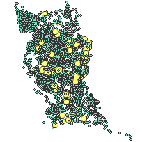
Geometric Objects:Object Type: pointObject Count: 12588 -
Reference System Information
-
Distribution Information
Distributor:Ontario Geospatial Data Exchange, Ministry of Natural Resources Peterborough Ontario, Canada -
Related Links