EcoZoneCoordinate system: 4269 - "NAD83" Abstract:Revision Note: Please note that this dataset has been revised and is available from the Land Information Ontario (LIO) Warehouse. An ecozone is a large sub-continental geographical division with distinct representative biotic and abiotic features in the ecological unit. Various systems exist to delineate natural regions based on ecological factors. MNR defines ecological units on the basis of bedrock, climate, physiography and corresponding vegetation, creating an Ecological Land Classification (ELC) system. The ELC of Ontario was revised by the ELC Working Group in 2000 to better reflect the ELC system originally developed by Angus Hills (1959 and later revisions). This dataset was revised to take account new information and new technology, while maintaining Hills's original concepts. For further information on the rationale for the revisions, refer to Ecoregions of Ontario Modifications to Angus Hills Site Regions and Districts, Revisions and Rationale, Crins and Uhlig 2000 . In 2002, the spatial data was updated using NRVIS drainage polygon data including islands from Great Lakes, St. Lawrence, and Ottawa River, and more detailed shoreline data. NTS mapping was also used to delineate the northern, eastern (Quebec border), and western (Manitoba border) boundaries of the province. In 2006, the shorelins of the Great Lakes, St. Lawrence, and Ottawa River were removed and the effected polygon boundaries were extended out over the water bodies to the extent of the provincial boundary. This modification was undertaken to provide a more generic data layer which is intended to be used as a selection tool, and as a backdrop upon which evolving and multi scalar hydorology layers may be overlain or intersected. |
Additional Documentation
-
Metadata Information
Language: eng; CANLast Update: 2012-09-11Other Maintenance Requirements:08d57ccf-ab9c-4006-948c-a458503a057bMetadata Contact:Scholars Portal, Ontario Council of University Libraries Toronto Ontario, CanadaContact Instructions:gis@scholarsportal.infoMetadata Standard:North American Profile of ISO19115:2003 - Geographic Information -
Citation Information
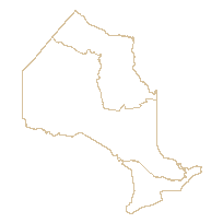
Ontario Ministry of Natural Resources Peterborough Ontario, CanadaThemes or Categories of the Resource: environmentKeywords:Eco zones, Eco districts, Eco regions, Environment, Ecological surveys, Ecology, Earth ScienceFORESTRY, LAND USE PLANNING, BIODIVERSITY, ECOLOGYEcology, Écologie, Land management, Forest management, Gestion forestière, Environnement, EnvironmentPlace Keywords:Continent > North America > Canada > OntarioPurpose:The ELC of Ontario is used for descriptive, planning, and resource management purposes. The upper levels in its hierarchy are most useful for provincial and regional roll-ups of data and for strategic planning, while the lower (finer-scale) levels of the hierarchy are most useful for detailed resource management prescriptions and other local and site planning applications. This layer is designed to be used as a spatial selection tool and as a background layer suitable for overlay and or intersection with numerous scales or current hydrologic data.Dataset Language:Status: completedUpdate Frequency: asNeededSpatial Representation Type: vectorProcessing Environment:ESRI Polygon Shapefile, ESRI Polygon Coverage, ESRI GeodatabaseExtentWest Longitude: -95.153668East Longitude: -74.320109North Latitude: 56.859365South Latitude: 41.676556
Supplemental Information: -
Spatial Representation - Vector
Geometric Objects:Object Type: curveObject Count: 3 -
Reference System Information
-
Data Quality Information
Scope Level: datasetHorizontal: NRVIS drainage scale mapping: 1:10K in south 1:20K in near north 1:50K in north 1:250K in Hudson Bay Lowlands
-
Distribution Information
Distributor:Ontario Geospatial Data Exchange, Ministry of Natural Resources Peterborough Ontario, Canada