Borehole - RetiredCoordinate system: 4269 - "NAD83" Abstract:Retirement note: please note that this dataset has been retired and replaced by Ontario Borehole Database, which is available from the Land Information Ontario (LIO) Warehouse. A borehole is the generalized term for any narrow shaft drilled in the ground, either vertically or horizontally. A borehole may be constructed for many different purposes including the extraction of water or fluid (such as oil) or gases (such as natural gas or methane), as part of a geotechnical investigation or environmental site assessment, for mineral exploration, or as a pilot hole for installing piers or underground utilities. This database contains a continuous log of strata for each borehole as well as for geocolumns. A geocolumn is a collection of information from an examination of exposed substrate, such as in a quarry wall or along a roadway passage. All measurements are metric. All depths are relative to the surface elevation. Supplementary tables (including a look-up table) can be used and are available for download from the additional documentation section. Supplementary look-up table descriptions are available in the Data Description document, which is available for download from the additional documentation section. |
Additional Documentation
-
Metadata Information
Language: eng; CANLast Update: 2013-02-20Other Maintenance Requirements:f03b2673-3a02-4e5f-8835-53deefc187eaMetadata Contact:Scholars Portal, Ontario Council of University Libraries Toronto Ontario, CanadaContact Instructions:gis@scholarsportal.infoMetadata Standard:North American Profile of ISO19115:2003 - Geographic Information -
Citation Information
Ontario Ministry of Northern Development, Mines and Forestry Sudbury Ontario, CanadaThemes or Categories of the Resource: geoscientificInformationKeywords:PLANNING, DEVELOPMENT, WATER USE, WATER RESOURCES MANAGEMENT, Water Resource Information Program, WATER MANAGEMENT, WATER ANALYSIS, GEOLOGY, WWIG FloodingDRINKING WATER, WATER ANALYSISDrilling, Forage, Water management, Gestion de l'eau, Geology, GéologiePlace Keywords:Continent > North America > Canada > OntarioPurpose:Geological and hydrologic analysis; gas and mineral exploration; environmental site assessment; underground construction. Boreholes of all types contribute to the delineation of the earth's subsurface, which includes aquifers. The extent and character of aquifers is important to Source Water Protection Planning and to broader water management.Dataset Language:Status: onGoingUpdate Frequency: irregularSpatial Representation Type: vectorProcessing Environment:Microsoft Access 2003, SP2Visual Basic 6Spatial data - Shapefile; Structured LIO/NRVISExtentWest Longitude: -89.498946East Longitude: -74.348844North Latitude: 56.018626South Latitude: 41.875174
Supplemental Information: -
Spatial Representation - Vector
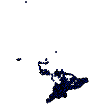
Geometric Objects:Object Type: pointObject Count: 95419 -
Reference System Information
-
Data Quality Information
Scope Level: dataset
City of Ottawa Geotechnical Borehole Database: Source data for the Borehole data set. Data collected from 01/01/1920 to 01/01/2006. The City of Ottawa obtained over 9000 geotechnical boreholes from Golder and Associates that were completed in the Ottawa area over the past 80 years. Of these, 8817 had coordinates and so were loaded into the provincial borehole database. The stratum descriptions were often quite detailed: color ranges, consistency ranges, moisture, texture, and material descriptions that differentiated between the main material and 'with', 'trace' and 'occasional' materials. Exact locational accuracy is not yet determined, but it is certainly better than many water wells in the area that often have lot centroids at best.MTO Boreholes from Engineering Reports: Source data for the Borehole data set. 950 to990s. Data collected from 01/01/1950 to 01/01/1990. The OGS obtained scans of engineering reports done for various Ministry of Transportation projects from 1950 to the 1990s. There was also a spatial index for these reports. This index does not provide specific locations for individual boreholes drilled for these reports, but the coordinates provide an excellent starting point for locating them using a GIS. An Access form was set up to enter descriptive information.While there are many private wells in the rural areas of southwestern Ontario, less than half of them have viable locations in the WWIS. It was decided to concentrate extraction efforts to reports from that area so that these boreholes will enrich the store of available data to draw on for describing the sub-surface in these areas.OGS Boreholes from Studies and Reports: Source data for the Borehole data set. 975 Onwards Data collected from 01/01/1975 to 01/01/2007. Over the years the Ontario Geological Survey (OGS) has progressed from paper maps to digital mapping and GIS. The store of geological knowledge is built up study by study and the result of these is often consolidated in map products. Some studies will employ boreholes to explore the sub-surface or record geo-columns of stratigraphy revealed in cliffs, but these have never been recorded in one central store. Successive studies will often reference the information found in previous studies by going back to the studies themselves.Locations and geological descriptions of boreholes and geo-columns were gleaned from OGS studies and placed in the provincial borehole database. An Access form was set up to enter descriptive information with data entry being performed under the oversight of the OGS. This is one data source for which BOREHOLE_SAMPLE and BOREHOLE_DATABASE_REF were designed.OGS Outcrops from YPDT (York-Peel-Durham-Toronto): Source data for the Borehole data set. 975 Onwards. Data collected from 01/01/1975 to 01/01/1990. Descriptions of outcrops from 1:50,000 geological maps produced by the Ontario Geological Survey were entered into the YPDT (York-Peel-Durham-Toronto) database of the Conservation Authority Moraine Coalition. Those with stratigraphy were extracted and entered into the provincial borehole database through a series of Access queries.Urban Geology Analysis Information System (UGAIS): Ontario Urban Centres. Source data for the Borehole data set. Early970s. Data collected from 01/01/1970 to 01/01/1975. The Urban Geology Analysis Information System (UGAIS) was assembled in the early 1970s. The Ontario databases (one for each urban center) are kept by the Ontario Geological Survey. All are ASCII text files of the same format except for the data set for Waterloo (known as WAGAIS), which has its own format. Programs were developed in Visual Basic to extract borehole information from these two data sets and load it into the provincial borehole database.Waterloo Geology Analysis Information System (WAGAIS): The Urban Geology Analysis Information System (UGAIS) was assembled in the early 1970s. The Ontario databases (one for each urban center) are kept by the Ontario Geological Survey. All are ASCII text files of the same format except for the data set for Waterloo (known as WAGAIS), which has its own format. Programs were developed in Visual Basic to extract borehole information from these two data sets and load it into the provincial borehole database. -
Distribution Information
Distributor:Ontario Geospatial Data Exchange, Ministry of Natural Resources (OMNR) Peterborough Ontario, Canada