Aquatic Feeding AreaCoordinate system: 4269 - "NAD83" Abstract:This data set is a polygon feature that can be used to identify a species-specific area that contains aquatic vegetation on which the species feeds. Different Aquatic Feeding Area types collected by the Natural Resources Values Information System (NRVIS) include: Supplementary tables can be used and are available for download from the additional documentation section. Supplementary look-up table descriptions are available in the data description document, which is available for download from the additional documentation section. This layer is part of what was known as the OMNR Non-Fundamental Dataset. |
Additional Documentation
-
Metadata Information
Language: eng; CANLast Update: 2013-11-04Other Maintenance Requirements:70a7e93f-d446-4fe1-9a4e-2094bf554e22Metadata Contact:Scholars Portal, Ontario Council of University Libraries Toronto Ontario, CanadaContact Instructions:gis@scholarsportal.infoMetadata Standard:North American Profile of ISO19115:2003 - Geographic Information -
Citation Information
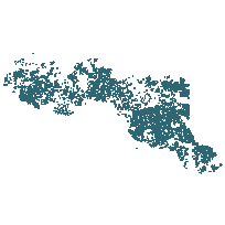
Ontario Ministry of Natural Resources Peterborough Ontario, CanadaThemes or Categories of the Resource: environmentKeywords:WILDLIFE, MOOSE, FEEDING HABITS, FEEDING, AQUATIC FEEDING, AQUATIC PLANTS, AQUATIC WEEDS, AQUATIC FOOD, WILDLIFE HABITAT, WILDLIFE MANAGEMENT, NON-FUNDAMENTALWILDLIFE, WILDLIFE HABITAT, WILDLIFE MANAGEMENT, FEEDING, FEEDING HABITS, AQUATIC PLANTS, AQUATIC WEEDSWildlife, Faune, Aquatic plants, Plante aquatique, Wildlife management, Gestion de la faunePlace Keywords:Continent > North America > Canada > OntarioPurpose:To identify the location and types of Aquatic Feeding Areas which are commonly found on maps for wildlife management purposes.Dataset Language:Status: onGoingUpdate Frequency: asNeededSpatial Representation Type: vectorProcessing Environment:Spatial locations and attributes are maintained by the OMNR's Natural Resources Values Information System (NRVIS).; Natural Resources Values Information System (NRVIS); Natural Resources Values Information System (NRVIS)ExtentWest Longitude: -95.150082East Longitude: -76.772330North Latitude: 51.445967South Latitude: 44.628506
Supplemental Information: -
Spatial Representation - Vector
Geometric Objects:Object Type: compositeObject Count: 87096 -
Reference System Information
-
Data Quality Information
Scope Level: dataset
Natural Resources Values Information System (NRVIS): A primary source for coincident base features (shorelines, streams, roads, cadastral boundaries, etc) as loaded into the Natural Resources Values Information System at the OMNR District level. NRVIS is MNR's system for managing it's corporate geographic databases. NRVIS standardizes the collection and maintenance of information (which allows for more reliable comparisons and analysis). NRVIS has been designed so it can be extended in terms of new data (geographic unit) types and additional functionality. NRVIS has been designed to allow for continuous updating, rather than 'spring house cleaning.' -
Distribution Information
Distributor:Ontario Geospatial Data Exchange, Ministry of Natural Resources (OMNR) Peterborough Ontario, Canada