Arc Hydro Quaternary Watershed SessionsCoordinate system: 4269 - "NAD83" Abstract:Arc Hydro (AH) is a geospatial and temporal data model for water resources, which operates within ArcGIS and was developed by the GIS in Water Resources (GISWR) Consortium in the United States. The Consortium is comprised of several members including: AH consists of a set of tools used to create and support a comprehensive water resources framework for hydrologic and related geospatial data analysis. The original focus of Arc Hydro was to support surface water modeling, but work has progressed into the groundwater realm. ESRI plans to link the two systems into one complete data modeling framework in the near future. The Ministry of Natural Resources - Water Resources Information Program (WRIP) was involved in a multi-year project to develop standardized Arc Hydro surface water data sessions based on the Quaternary Watershed fabric for the Province of Ontario. Each session contains foundation layers required for fundamental hydrologic watershed analysis. To meet the requirements of Arc Hydro, the project team followed rigorous quality checking and assurance procedures which resulted in extensive and significant base data improvements across the Province. These enhancements are regarded collectively as a 'snapshot' version of our hydrology base and derivative products. Base data updates are happening on a continual basis, which will have implications on any derivative or related product that has been produced to date by the Province. Any further work in Arc Hydro will depend on available resources and support from the various business areas interested in utilizing these data and tools. Some key elements of the project include: |
Additional Documentation
- WRIP Technical Report and Guidelines: The Arc Hydro Quaternary Watershed Project
- WRIP InfoSheet: Guidelines for Getting Started with MNRs Arc Hydro Quaternary Watershed Sessions
- WRIP Technical Release: Extending the Hydro Network Using Arc Hydro and ArcGIS
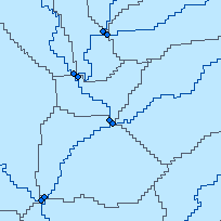
- PGSC Technical Release: Global Delineation for Split Watersheds
- WRIP InfoSheet: Creating 125 Hectare Headwater Watersheds
-
Metadata Information
Language: eng; CANLast Update: 2014-06-02Other Maintenance Requirements:32a124d1-d3ce-4556-8bf1-d40c3bdcb4d1Metadata Contact:Scholars Portal, Ontario Council of University Libraries Toronto Ontario, CanadaContact Instructions:gis@scholarsportal.infoMetadata Standard:North American Profile of ISO19115:2003 - Geographic Information -
Citation Information
Ontario Ministry of Natural Resources Peterborough Ontario, CanadaThemes or Categories of the Resource: geoscientificInformationKeywords:WATER, WATER MANAGEMENT, HYDROGRAPHY, WATER RESOURCES, WATER ANALYSIS, HYDROLOGY, DRAINAGE, CATCHMENTS, CATCHMENT HYDROLOGY, WATERSHEDSWATER, WATER MANAGEMENT, Watersheds, WATER RESOURCES, WATER ANALYSIS, HYDROLOGY, DRAINAGE, CATCHMENTSWater, Eau, Water management, Gestion de l'eau, Hydrography, Hydrographie, Hydrology, Hydrologie, Watersheds, Bassin hydrologique, Drainage, DrainagePlace Keywords:Continent > North America > Canada > OntarioPurpose:These AH sessions were developed and tested originally for Version 1.1 Arc Hydro tools on the ArcGIS 9.1 platform in the Personal Geodatabase format (.MDB). Later versions of the tool appear to have undergone some fundamental data model changes that affect how the watershed delineation functions operate. Because of this, we have have upgraded the sessions so that they are compatible with Arc Hydro Tools Version 1.3 or later. Appendix 2 of the Technical Bulletin included with the AH sessions describes the procedure followed for updating the old sessions, which may be useful for end users in their own AH implementations. These AH sessions are not considered complete data models. They are a beginning framework for conducting further analysis to meet your specific needs. Certain elements of the data model are populated using the 10k/20k NRVIS and WRIP hydrology base data sets. Some fields within the layers may not be populated at this time, but they are included to give the user an idea of what can be stored in these feature classes. A basic geometric network can be created containing a default temporary junction feature class, but we recommend that you create your own permanent Hydrojunction feature class to be used as part of the geometric network (see Working with the Geometric Network section for details). The AH sessions are not limited to use in Arc Hydro. The data is easily accessible without having to install Arc Hydro and can be exported for use in other software applications. However, you will not be able to realize the full potential of the data relationships established without having AH or related tools available to assist you in your analysis. Complete data model templates are available from WRIP to add additional feature classes to the AH sessions as needed for your analysis. Some components as described in the Model Overview (Section 7) are included as empty feature classes for the user to populate (such as the watershed point and polygon feature classes). The feature classes that were populated were those specifically required by ARDB to complete their stream site analysis project. This AH product can be used for regional scale analysis for a variety of purposes. It is not intended for detailed site level analysis. Currently, there is no intention to incorporate higher resolution data sources into this product. If you prefer to use your own data sources, you can add to the existing model, provided you honour its original intended scale, or you can use the principles and templates that are available to create your own Arc Hydro sessions using your own data. The Provincial data is provided 'as-is' and there are currently no plans for further enhancements or updates until MNR's Hydrographic Data Strategy Project has been fully realized and implemented. One component of this Strategy, which is known as 'water flow consolidation', involves developing a new standard hydrographic model to bring together disparate versions of data being managed or updated by different partners within and external to the MNR. In the interim, if users notice any data discrepancies or stream network connectivity issues, these issues will be logged by WRIP when notified and will be forwarded to the proper data custodian (as determined by the Strategy) after the fall of 2009 (the anticipated completion of the water flow consolidation phase). For further information on the Hydrographic Data Strategy, contact the Base Data Infrastructure group of the MNR in Peterborough.Dataset Language:Status: completedUpdate Frequency: asNeededSpatial Representation Type: gridProcessing Environment:ESRI Arc GIS 9.2 Personal Geodatabase using AH Tools Version 1.3.; A series of Quaternary Personal Geodatabases (MDB) / Raster Layers / Project Map Files (ESRI MXD) packaged by Tertiary Watershed.ExtentWest Longitude: -93.98333East Longitude: -74.31667North Latitude: 50.78333South Latitude: 41.66667
Supplemental Information: -
Reference System Information
-
Data Quality Information
Scope Level: dataset
Water Resources Information Program: WRIP virtual water flow network v2.1.0: The WRIP water flow is used to create the hydrographic network portions of the AH session. It is also an input in the creation of the DEM and EFD products. The Water Virtual Flow data set is a fully connected, flow directed, stream network with complete topological flow structure. The data was originally based on the Natural Resources Values Information System (NRVIS) Water Body Segment layer and has been updated to create connectivity and flow direction. Streams may also have been edited using information from reliable local sources such as Conservation Authorities and MNR districts. The entire data set has been updated August 2005 incorporating edits received from partners of the Water Resources Information Program, and have since been updated as a result of QA/QC work performed during the Arc Hydro project.Water Resources Information Program: Provincial Digital Elevation Model v2.0.0 (DEM): An input in the creation of the Enhanced Flow Directions (EFD) grids. A 3-dimensional raster data set which captures terrain elevations and covers the province of Ontario to the 51st parallel composed of 150 tiles. Cell resolutions are 20 metres in northern Ontario and 10 metres in southern Ontario. The provincial DEM was interpolated using five main datasets: Contour Line, OBM-DTM, Spot Height, Water Poly Segment, Water Virtual Flow.Water Resources Information Program: Enhanced Flow Directions v2.1.0 (EFD, EFDIR): The Enhanced Flow Direction Grid is a grid representing surface flow directions derived from Version 2.0 Digital Elevation Model (DEM) with the added enhancement of having the photogrammetrically mapped hydrology (WRIP Water Virtual Flow and NRVIS water body segment) embedded within the grid so that known hydrology is accurately represented within the grid. -
Distribution Information
Distributor:Ontario Geospatial Data Exchange, Ontario Ministry of Natural Resources (OMNR) Peterborough Ontario, Canada