The State of Canada's Ecosystems in MapsCoordinate system: 9802 Abstract:EcoMAP (Ecological Mapping Analysis and Protocols) is a suite of geospatial data sets and analysis applications featuring ecological zones. They have been developed by GeoInsight Corporation and A.M. Turner and Associates over the past three years with support from a number of government agencies. Parts of the EcoMAP database have been used to present a national perspective of many ecological themes through the National Atlas of Canada. In order to provide continuity the EcoMAP name has been adopted for the National Atlas ecological module. |
-
Metadata Information
Language: eng; CANLast Update: 2011-10-05Other Maintenance Requirements:Metadata was created using existing FGDC metadata supplied by GeoGratis.Metadata Contact:Scholars Portal, Ontario Council of University Libraries Ontario, CanadaMetadata Standard:North American Profile of ISO19115:2003 - Geographic Information -
Citation Information
SeriesName: GeoGratis Open Data
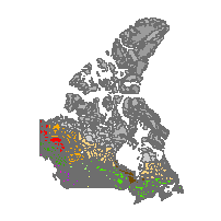
Natural Resources Canada Ottawa Ontario, CanadaThemes or Categories of the Resource: environmentKeywords:Open data, Land cover, EcologyAGRICULTURE, BIOLOGICAL INDICATORS, URBAN AREAS, LAND USE, WOOD, WETLANDS, ECOLOGYBiodiversity, Aquatic ecosystems, Lakes, Streams, Ecological monitoring, Terrestrial ecosystems, Vegetation, Contaminants, Land use, Land ecosystems, Landscape management, Ecology, ÉcologiePlace Keywords:Continent > North America > CanadaPurpose:Work is proceeding on many fronts to protect Canada's ecosystems. Activities include establishing protected areas to help conserve ecosystems and implementing species and habitat recovery programs. The federal government now provides tax incentives to individuals for donations of lands for conservation purposes. Industries such as forestry and agricultural are incorporating ecosystem management practices into their working practice. The success of the EcoMAP concept has been demonstrated through several applications such as: 1. The modelling of the relative risk to terrestrial biodiversity in Canada, 2. The computation and mapping of the amount of protected wetland area in Canada, 3. The computation and mapping of the amount of protected forested area in Canada, 4. The modelling of habitat distributions by species and guilds, 5. A modelling scheme to help identify and prioritize the most efficient conservation areas network.Dataset Language:Status: completedUpdate Frequency: asNeededSpatial Representation Type: vectorExtentWest Longitude: -141.004708East Longitude: -52.636292North Latitude: 83.110626South Latitude: 41.708294
Supplemental Information: -
Spatial Representation - Vector
Geometric Objects:Object Type: curveObject Count: -
Reference System Information
-
Distribution Information
Distributor:GeoGratis User Support Group Sherbrooke Quebec, Canada -
Related Links