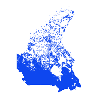
Minor Name Points (MNNMP)Coordinate system: 4326 - "WGS 84" Abstract:Minor Name Points represent the name of smaller waterbodies such as small lakes, rivers or creeks. These features are associated with water lines or minor water regions. Minor Name Points are engineered from a combination of National Topographic Data Base (NTDB) 1:50,000 and 1:250,000 scale hydrographic mapping data. Note: In 2012, there was a datum change from NAD83 to WGS84. |
Additional Documentation
- CanMap Water User Guide v2012.3 (most current)
- CanMap Water User Guide v2011.3
- CanMap Water User Guide v2010.3
- CanMap Water User Guide v2009.3
- CanMap Water User Guide v2008.3
- CanMap Water User Guide v2007.3
- CanMap Water User Guide v2006.3
- CanMap Water User Guide v2005.3
- CanMap Water User Guide v2003 1.2
-
Metadata Information
Language: eng; CANLast Update: 2015-07-02Other Maintenance Requirements:This metadata was automatically generated from the FGDC Content Standards for Digital Geospatial Metadatastandard version FGDC-STD-001-1998.Metadata Contact:Scholars Portal, Ontario Council of University Libraries Toronto Ontario, CanadaContact Instructions:gis@scholarsportal.infoMetadata Standard:ISO 19115-2 -
Citation Information
SeriesName: CanMap Water
DMTI Spatial Inc. Markham Ontario, CanadaThemes or Categories of the Resource: inlandWatersKeywords:Canada, Water, Hydro, Hydrographic, Waterbody, Names, ToponymHYDROLOGYWater, Rivers, Lakes, Hydrography, Eau, Cours d'eau, Lac, HydrographiePlace Keywords:Continent > North America > CanadaPurpose:To create a nation-wide hydrographic dataset which can be used as an accurate base for GPS applications, cartographic display or web mapping applications.Dataset Language:Status: completedUpdate Frequency: annuallySpatial Representation Type: vectorProcessing Environment:Native Dataset Environment: Microsoft Windows 2000 Version 5.2 (Build 3790) Service Pack 2; ESRI ArcCatalog 9.1.0.780ExtentWest Longitude: -141.001629East Longitude: -52.578580North Latitude: 83.469556South Latitude: 41.700043
Supplemental Information:DMTI Spatial Inc Markham Ontario, Canada -
Spatial Representation - Vector
Geometric Objects:Object Type: pointObject Count: 257963 -
Reference System Information
-
Name of the test:Measure produced by the test:Quality test results:Value Units: Result value:Name of the test:Measure produced by the test:Quality test results:Value Units: Result value:
-
Distribution Information
Distributor:DMTI Spatial Inc. Markham Ontario, Canada