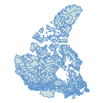
Watersheds RegionCoordinate system: 4326 Abstract:This layer indicates watersheds across Canada. Also known as a drainage basin or catchment area, a watershed is a boundary dividing an extent of land where water from rain or snow melt drains downhill into a body of water. Each feature in this layer includes the name of the watershed and which ocean it flows towards. Additional tables and supporting documentation are available in the Data Dictionary and User Manual. |
Additional Documentation
- Scholars GeoPortal DMTI Spatial Data Terms of Use
- CanMap Content Suite - User Manual 2023.3
- CanMap Content Suite - Release Notes 2023.3
- CanMap Content Suite - Data Dictionary 2023.3
- CanMap Content Suite - FAQ and Support 2023.3
- CanMap Content Suite - Index 2023.3
- CanMap Content Suite - User Manual 2022.3
- CanMap Content Suite - Release Notes 2022.3
- CanMap Content Suite - Data Dictionary 2022.3
- CanMap Content Suite - FAQ and Support 2022.3
- CanMap Content Suite - Index 2022.3
- CanMap Content Suite - User Manual 2021.3
- CanMap Content Suite - Release Notes 2021.3
- CanMap Content Suite - Data Dictionary 2021.3
- CanMap Content Suite - FAQ and Support 2021.3
- CanMap Content Suite - Index 2021.3
- CanMap Content Suite - User Manual 2020.3
- CanMap Content Suite - Release Notes 2020.3
- CanMap Content Suite - Data Dictionary 2020.3
- CanMap Content Suite - FAQ and Support 2020.3
- CanMap Content Suite - Index 2020.3
- CanMap Content Suite - User Manual 2019.3
- CanMap Content Suite - Release Notes 2019.3
- CanMap Content Suite - Data Dictionary 2019.3
- CanMap Content Suite - FAQ and Support 2019.3
- CanMap Content Suite - Index 2019.3
- CanMap Content Suite - User Manual 2018.3
- CanMap Content Suite - Release Notes 2018.3
- CanMap Content Suite - Data Dictionary 2018.3
- CanMap Content Suite - FAQ and Support 2018.3
- CanMap Content Suite - Index 2018.3
- CanMap Content Suite - User Manual 2017.3
- CanMap Content Suite - Release Notes 2017.3
- CanMap Content Suite - Data Dictionary 2017.3
- CanMap Content Suite - FAQ and Support 2017.3
- CanMap Content Suite - Index 2017.3
- CanMap Content Suite - User Manual 2016.3
- CanMap Content Suite - Release Notes 2016.3
- CanMap Content Suite - Data Dictionary 2016.3
- CanMap Content Suite - FAQ and Support 2016.3
- CanMap Content Suite - Index 2016.3
- CanMap Content Suite - User Manual 2015.3
- CanMap Content Suite - Release Notes 2015.3
- CanMap Content Suite - Data Dictionary 2015.3
- CanMap Content Suite - FAQ and Support 2015.3
- CanMap Content Suite - Index 2015.3
-
Metadata Information
Language: eng; CANLast Update: 2023-11-08Metadata Contact:Scholars Portal, Ontario Council of University Libraries Toronto Ontario, CanadaContact Instructions:datagis@scholarsportal.infoMetadata Standard:ISO 19115-2 -
Citation Information
SeriesName: CanMap Content Suite
DMTI Spatial Inc. Markham Ontario, CanadaThemes or Categories of the Resource: environmentKeywords:Drainage Basin, Catchment AreaWatersheds, Bassin hydrologiquePlace Keywords:Continent > North America > CanadaDataset Language:Status: completedUpdate Frequency: quarterlySpatial Representation Type: vectorProcessing Environment:Windows 10 Enterprise Version 22H2 (Build 19045.2604) Windows feature experience pack 120.2212.4190.0; Esri ArcGIS 10.6.1sExtentWest Longitude: -145.437273East Longitude: -52.63629192North Latitude: 83.110626South Latitude: 41.00379201
Supplemental Information: -
Spatial Representation - Vector
Geometric Objects:Object Type: composite -
Reference System Information
-
-
Distribution Information
Distributor:DMTI Spatial Inc. Markham Ontario, Canada