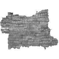
1934 Air Photos of Niagara RegionCoordinate system: 4269 - "NAD83" Abstract:This data set is a scanned reproduction of the 1934 air photos from the Canada Department of Energy, Mines, and Resources, held in the Brock University Library collection. This image service provides a mosaic of the geoTIFF images (aerial photographs) for the Niagara Region. The coverage area includes the Niagara peninsula from approximately, Grimsby, Ontario in the west to the Niagara River in the East and Lake Ontario shoreline in the North to Lake Erie shoreline in the south. This image service was updated in December 2017 to provide enhanced georeferencing and edge matching. |
Additional Documentation
-
Metadata Information
Language: eng; CANLast Update: 2014-12-04Metadata Contact:Map, Data & GIS Library, Brock University St. Catharines Ontario, CanadaContact Instructions:geoportal@scholarsportal.infoMetadata Standard:North American Profile of ISO19115:2003 - Geographic Information -
Citation Information
Canada Department of Energy, Mines, and Resources Ottawa Ontario, CanadaMap, Data & GIS Library, Brock University St. Catharines Ontario, CanadaThemes or Categories of the Resource: imageryBaseMapsEarthCoverKeywords:Historical analysis, Air photoAerial photographyPlace Keywords:Continent > North America > Canada > Ontario, Niagara RegionPurpose:Aerial photography has many practical applications such as map-making, urban and rural planning, environmental impact studies, civil law cases, real estate evaluations and more.Dataset Language:Status: completedUpdate Frequency: asNeededSpatial Representation Type: gridProcessing Environment:Microsoft Windows Server 2008 R2 Version 6.1 (Build 7601) Service Pack 1; ESRI ArcGIS 10.0.2.3200ExtentWest Longitude: -79.8East Longitude: -78.9North Latitude: 43.3South Latitude: 42.8
Supplemental Information: -
Spatial Representation - Grid:
Number of dimensions: 2Axis dimensions properties: -
Reference System Information
-
Data Quality Information
Scope Level: dataset
Process step:Map, Data & GIS Library, Brock University: Original air photos in the library collection were scanned at 600 dpi; mosaicked into sections; and georeferenced in Geographic Imager to create the GeoTIFFs.National Air Photo Library (NAPL): Original photos are part of the Canada National Air Photo Library (NAPL) of Natural Resources Canada and are held in the Brock University Library collection. NAPL archives over six million aerial photographs covering all of Canada, some of which date back to the 1920s. -
Distribution Information
Distributor:Map, Data & GIS Library, Brock University St. Catharines Ontario, Canada